FAIR is a non-profit organization dedicated to providing well-documented answers to criticisms of the doctrine, practice, and history of The Church of Jesus Christ of Latter-day Saints.
m (Bot: Automated text replacement (-{{Articles FAIR copyright}} +{{FairMormon}})) |
m (Bot: Automated text replacement (-{{Articles(.*)}} +)) |
||
| Line 1: | Line 1: | ||
{{FairMormon}} | {{FairMormon}} | ||
{{BoMGeoTableStart}} | {{BoMGeoTableStart}} | ||
{{BoMGeo:Olsen_2004_RAW}} | {{BoMGeo:Olsen_2004_RAW}} | ||
| Line 10: | Line 10: | ||
{{Endnotes label}} | {{Endnotes label}} | ||
<references /> | <references /> | ||
Contents |
| Model Name | Date Proposed | Scope | Narrow Neck | Land North | Land South | Cumorah | River Sidon | Nephi's Landing | Religion | Type of model | |
|---|---|---|---|---|---|---|---|---|---|---|---|
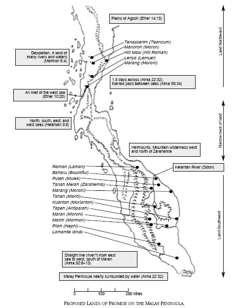
| Olsen 2004 | 2004 | Non-Western Hemisphere | Malay Peninsula | Malaysia | Malaysia | Other | Kelantan | Malaysia | LDS | External | edit |


FAIR is a non-profit organization dedicated to providing well-documented answers to criticisms of the doctrine, practice, and history of The Church of Jesus Christ of Latter-day Saints.
We are a volunteer organization. We invite you to give back.
Donate Now